|
| *****SWAAG_ID***** | 782 |
| Date Entered | 04/03/2014 |
| Updated on | 04/03/2014 |
| Recorded by | Tim Laurie |
| Category | Geological Record |
| Record Type | Geological HER |
| Site Access | Private |
| Record Date | 04/03/2014 |
| Location | Swaledale in the vicinity of Ellerton Abbey |
| Civil Parish | Ellerton Abbey |
| Brit. National Grid | SE 075 972 |
| Altitude | 200m |
| Geology | See attached Text: 'A brief account of the Geology of Ellerton' by John Russell (Image Nos 1 and 2) Explanatory Figure(Image No 3) and Photographs (Image Nos 4-7). |
| Record Name | A brief account of the Geology of Ellerton by John Russell. |
| Record Description | This Record comprises a brief account of the Geology and Late Glacial Landforms of the Lower Swale Valley together with an illustrative sketch and photographic images of the Recessional Moraine and Recessionary Collapse Structure in the vicinity of Swale Farm and of Ellerton Abbey. |
| Additional Notes | Please click on Images 1 and 2 to read text. |
| Image 1 ID | 5154 Click image to enlarge |
| Image 1 Description | | 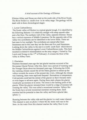 |
| Image 2 ID | 5155 Click image to enlarge |
| Image 2 Description | | 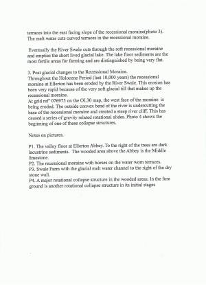 |
| Image 3 ID | 5156 Click image to enlarge |
| Image 3 Description | | 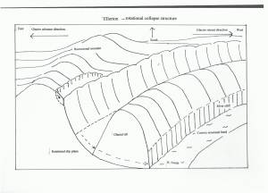 |
| Image 4 ID | 5157 Click image to enlarge |
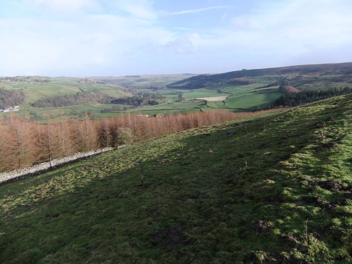
| Image 4 Description | The valley floor at Ellerton Abbey. To the right of the trees the ploughed field shows dark lacustrine sediments. The wooded bank on the northern side of the River Swale is formed by strata of the Middle Limestone. | 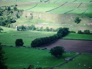 |
| Image 5 ID | 5158 Click image to enlarge |
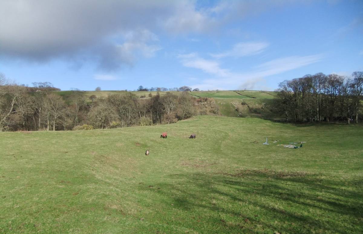
| Image 5 Description | The recessional moraine. Horses graze on the water worn terraces. | 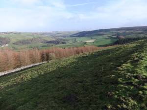 |
| Image 6 ID | 5159 Click image to enlarge |
| Image 6 Description | Swale Farm pastures. Glacial melt water channel to the right of the drystone wall. |  |
| Image 7 ID | 5160 Click image to enlarge |
| Image 7 Description | Rotational structures above the south bank of the Swale at Swale Farm | 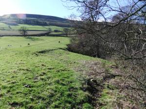 |